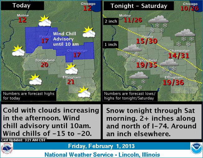
Bitterly cold temperatures in the
single digits will start the day Friday, combined with gusty winds
and wind chills of 15 to 20 below that will continue until about 10
a.m. Then temperatures will slowly warm Friday afternoon, only
reaching into the 15- to 22-degree range.
Clouds will also be on the increase
and bring light snow to the area for Friday night through Saturday
morning. By morning, snowfall amounts will be 1-2 inches across a
good portion of central and eastern Illinois. Higher amounts of
2-plus inches will be along and north of a line from Galesburg to
Paris, roughly Interstate 74.
Temperatures will warm Friday night through Saturday, reaching
into the 30- to 35-degree range. Several other clipper systems will
move across the area from this weekend into the middle of next week.
Snowfall amounts will be light with each system. In addition,
temperatures should warm, with highs ranging from the middle 30s to
lower 40s.
For updates, check http://www.crh.noaa.gov/ilx/.
[Text from National Weather Service,
Lincoln office]